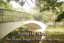
Across the Water
Five historic bridges that BU students can walk to—and over
Boston is a walkable city and its bridges offer a chance to sample neighborhoods, catch some of the best views of the downtown skyline, and plan your next trip down the river — whether by kayak, canoe, sailboat, or dragon boat.
BU Bridge
Linking BU with Cambridge, this 1928 concrete and steel arc crosses over Storrow Drive, the BU sailing pavillion, and an old railroad bridge. The stairway on the BU side of the bridge does not provide access to the BU sailing boathouse as it leads to the inbound side of Storrow Drive, and pedestrians can sometimes be seen tempting fate by dashing across the busy highway. The riverbank on the Cambridge side is home to a gaggle of geese and ducks. More intrepid than the boldest of pedestrians, these geese have been known to bring traffic to a grinding halt as they saunter leisurely across Memorial Drive.
From there, a 20-minute walk along Brookline Street through the quiet residential neighborhood of Cambridgeport will bring you to Central Square, where you can catch the Red Line or sample the area’s many bars and restaurants. Among these, the Middle East Restaurant and Nightclub {http://www.mideastclub.com} offers a choice of live local bands or belly dancing on any given night.
Lars Anderson Bridge
This four-lane bridge was built in 1915 to replace the wooden drawbridge that was the first across the Charles. Connecting Harvard’s main campus with the Harvard Business School, this short but busy bridge crosses from the immaculately groomed grass and shaded benches of the Business School to the John F. Kennedy Park. An extra hike through the Harvard athletic fields brings you to the park by Soldiers Field Road, where a Charles River Canoe and Kayak {http://www.ski-paddle.com/main.php} kiosk rents boats by the hour. Busy bike trails line both banks of the river, further connecting the campuses.
Walking two blocks past the Harvard boathouse will bring you to the Harvard Square T stop and a wide assortment of ethnic restaurants and cafes ranging from the quaint to the upscale, street musicians, artists, and mimes. One of the best ethnic restaurants is Tamarind Bay, which has the seal of approval of local Indians for its subtle use of spices.
Weeks Bridge
A popular spot for Harvard graduates to tie the knot, this 1924 footbridge connects Harvard University to the Harvard Business School. The bridge is a five-minute walk downstream from the Lars Anderson Bridge, and both bridges reflect the architectural harmony of Harvard’s buildings. The small brick and stone bridge is also the only pedestrian bridge that spans the river. Its three graceful arches and the decorative railing provide a nice vantage from which to watch boaters toiling on the river. A short walk past residential buildings on Harvard’s campus brings you back to Harvard Square.
Longfellow Bridge
Local lore has dubbed this the “salt and pepper bridge” for its characteristic stone towers. Built in 1906, the bridge named for Henry Wadsworth Longfellow predates the Boston subway system. The Red Line shares the bridge with cars and provides commuters with the best view on the T system, including Kenmore Square’s landmark CITGO sign. After a ride down the Red Line from Harvard Square, get out at Kendall Square on the edge of MIT’s campus. The walk from Kendall Square across the bridge is the longest distance, taking about 15 minutes. Cross the bridge on the right side, from where you can view the sailboats radiating out from Community Boating {http://www.community-boating.org/}, the oldest public sailing program in the country. Alternatively, you may — as on a recent windy day — watch the rescue of a hapless boater clinging to his overturned sailboat.
The still-in-progress Charles/MGH T stop is at the end of the bridge, as are the narrow cobbled streets and elegant brownstones of Beacon Hill. Upper Crust Pizza on Charles Street serves up pizza so thin and crunchy the pizzeria could be a transplant from Naples.
Continuing along the bank of the Charles from the Community Boathouse is the Charles River Esplanade, an oasis of jogging, biking, and sunsets reflected in the water of man-made lagoons, as well as the home of the Hatch Shell, the perfect place to catch an outdoor summer concert.
Charles River Dam
The Charles River Dam was constructed in 1910 to create a freshwater basin and a riverfront park area. Though no longer in use, the dam operates a boat lock, and the bridge can open, allowing larger boats to pass. However, the main reason to descend the Green Line at Science Park Station is not the view of still water from a sliver of park near the lock but a chance to act like a big kid at the Museum of Science. After playing with the hands-on exhibits, skip the museum cafes and instead walk past the museum parking garage and descend to the dam. Follow a walkway lined with benches around the water to the CambridgeSide Galleria mall and the Cheesecake Factory.
Boston Duck Tours in restored amphibious vehicles from World War II leave regularly from the museum and provide a different perspective of the city and its bridges from the river.
Color illustrations and black and white photos are from the book, “Inventing the Charles River,” by Karl Haglund, published by the Charles River Conservancy