Preservation Planning: Beacon Hill and the West End Neighborhood Studies
A core course in our MA program, Preservation Planning (AM 554) seeks to help students understand the “process that organizes preservation activities (identification, evaluation, registration and treatment of historic properties) in a logical sequence.” As a part of the class, students are required to walk through two neighborhoods in Boston – Beacon Hill and the West End.
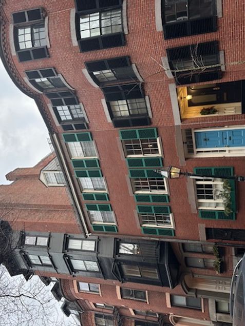
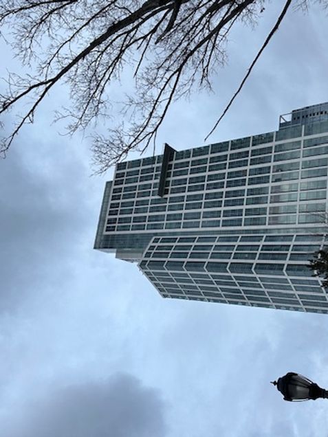
The goal of the assignment is to gain insight into the impact of urban renewal on traditional urban fabric by comparing the streetscape of historic Beacon Hill and with that of the West End urban renewal project area. Students, in small groups or independently, worked through the two neighborhoods, analyzing the impact of urban renewal in the area and how the streetscapes changed moving from Beacon Hill into the West End, as seen in the two photos provided. The tight, pedestrian-centered streets of Beacon Hill open up to the wide, vehicle and industry focused streets of the West End. Students shared their findings and photos with the class.
The goal of the assignment is to gain insight into the impact of urban renewal on traditional urban fabric by comparing the streetscape of historic Beacon Hill and with that of the West End urban renewal project area. Students, in small groups or independently, walked through the streets, moving from Beacon Hill to the West End and observing how the streetscape changed.
As the first assignment in this class, the walk and subsequent paper serves to create a strong foundation of understanding for city planning and preservation, and how the two are intertwined – while also frequently being at odds.