Heat Waves Are Scorching Boston, but Are Some Neighborhoods Hotter than Others?
BU researchers team up with city of Boston and local nonprofits to improve temperature monitoring and pilot a more equitable approach to declaring heat emergencies
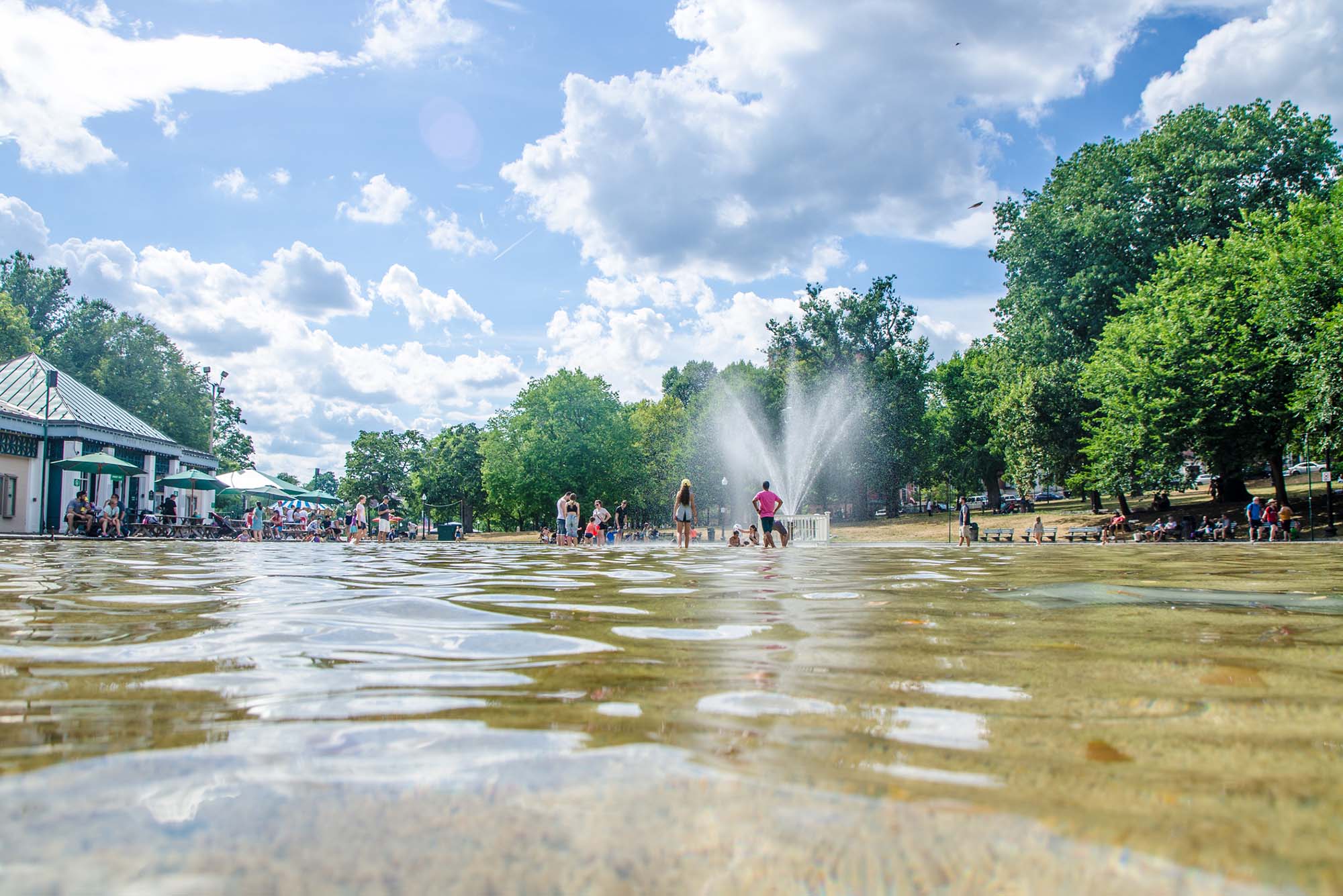
Cooling down at Boston Common Frog Pond during a heat wave. A new project aims to better analyze hot spots around Boston to help the city make more informed and equitable heat emergency declarations. Photo via iStock/Marc Dufresne
Heat Waves Are Scorching Boston, but Are Some Neighborhoods Hotter than Others?
BU researchers team up with city of Boston and local nonprofits to improve temperature monitoring and pilot a more equitable approach to declaring heat emergencies
It’s hot out there: summer’s blazing temperatures have fried records across the country, from Portland, Maine, to Tucson, Ariz. And it’s been cooking right here in Boston, too, where a recent heat wave scorched a century-old record high.
But Boston, like many other cities, doesn’t swelter equally. The heat island effect means some parts of the city warm up more than others when summer temperatures soar. While parks and other areas with green space and greater tree cover provide shade, and cool the air through evaporation and transpiration, the dark roofs and asphalt of densely developed areas absorb and radiate the sun’s heat. Despite its diversity of environments, Boston decides whether it’s in a heat wave from temperature readings at just one site: Boston Logan International Airport.
A team of Boston University researchers is trying to change that. They’re part of a yearlong initiative, in collaboration with the city of Boston’s Environment Department and local nonprofits A Better City and The Boston Foundation, to pilot a more equitable mechanism for declaring heat emergencies.
“Heat is increasing in intensity and frequency across the globe due to climate change, and every day, more connections are made between extreme heat and adverse health, including mental health,” says Patricia Fabian, a BU School of Public Health associate professor of environmental health and an associate director at the BU Institute for Global Sustainability. She’s one of the pilot project leads. “Extreme heat impacts everyone, but particularly vulnerable groups like babies, pregnant people, older adults, and people on certain medications. Having accurate information about temperatures in local heat islands will help cities prepare for extreme heat events and protect those most vulnerable.”
Analyzing Data on Hot Spots
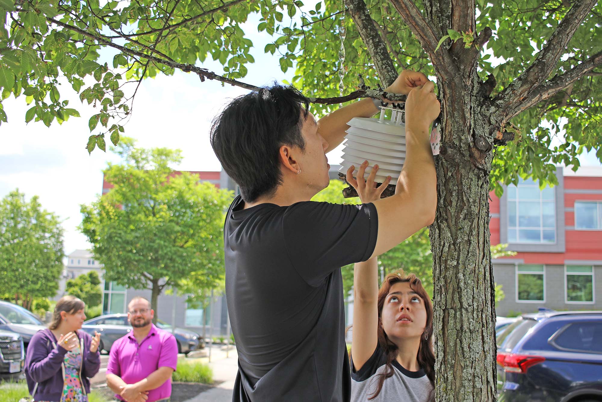
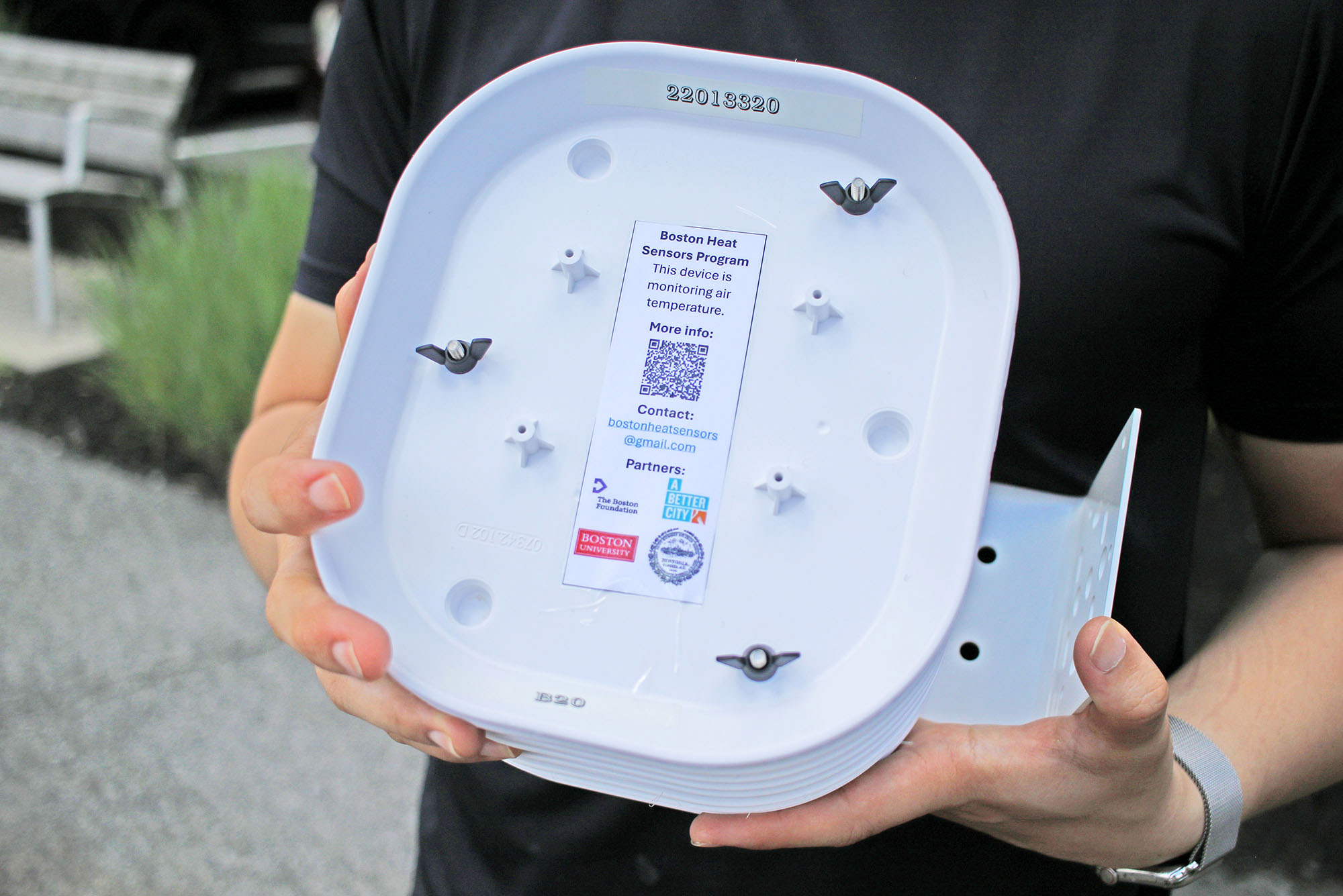
On a recent sultry Boston morning, BU environmental health researcher Jonathan Lee was perched on a ladder, balancing a white box about the size of a small toaster against the crook of a tree. He secured the box to the tree with a few zip ties and then stepped down to ensure that it was just out of reach from the ground, but the QR code printed on its bottom was still readable to passersby.
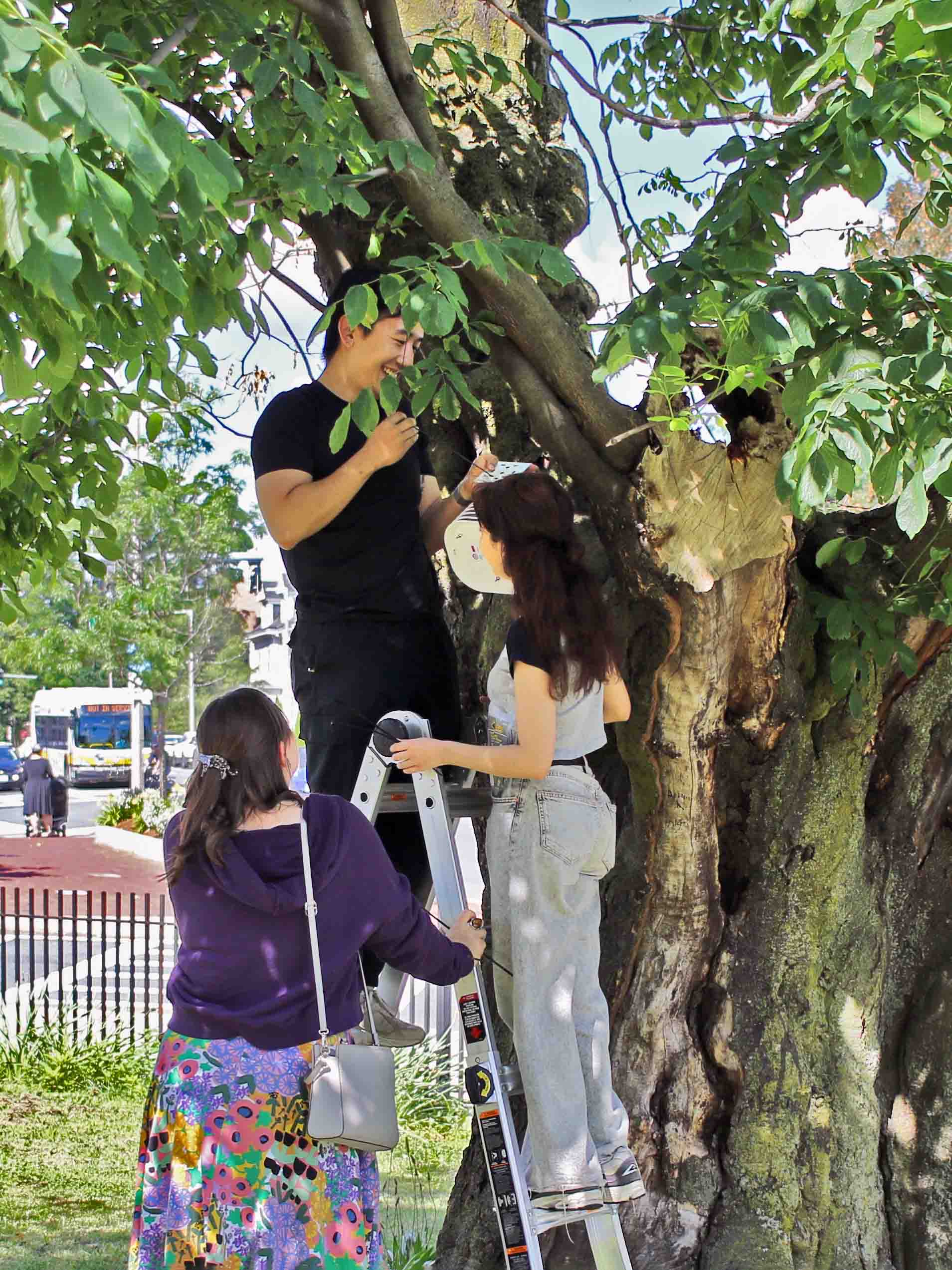
Over the past few weeks, Lee (SPH’30), an environmental health PhD student in Boston University’s Graduate Program in Urban Biogeoscience & Environmental Health (URBAN), and Ameera Saba (ENG’27), a BU biomedical engineering undergraduate, have crisscrossed the city deploying these white boxes in various Boston neighborhoods.
While A Better City engages local businesses as sensor hosts, BU students assemble and install the sensors, and collect and analyze the data. One of the project’s cofounders, Zoe Davis, climate resilience project manager on the Climate Ready Boston team, helped facilitate installation of the sensors in city trees. The work is being funded through The Boston Foundation.
The team is particularly focused on monitoring temperatures in Boston neighborhoods identified as the hottest in the city’s heat resilience plan: Chinatown, Dorchester, East Boston, Mattapan, and Roxbury. Through another research project called C-HEAT, Fabian and her colleagues have recorded up to a seven-degree difference between hotter and cooler city blocks in nearby Chelsea.
Currently, the National Weather Service (NWS) station at Logan Airport determines the official temperature reading for Boston. To declare a heat emergency, the NWS sensors must register a heat index (air temperature and relative humidity) of 95 degrees for at least two consecutive days with nighttime temperatures 75 degrees or higher. With the help of students like Lee and Saba, Fabian and Isabella Gambill, A Better City’s assistant director of climate, energy, and resilience, will monitor a total of 15 sensors throughout the city, gathering and analyzing data on hot spots.
Lee, who installed similar sensors in Chelsea for C-HEAT, turned to data on temperature, built infrastructure, and environmental justice to map potential sites for the pilot sensors. “[The NWS] temperature monitor is used by the city of Boston to issue heat emergencies, but we hypothesize that sometimes inner-city areas can get considerably hotter,” he says.
Fabian and the team aim to eventually launch a permanent sensor network with the city of Boston, and make neighborhood temperature data publicly accessible online via a platform similar to the Boston Public Schools’ dashboard for monitoring indoor air quality in classrooms, a project Fabian has collaborated on.
The sensors could not only prove useful in protecting public health during future heat waves, says Fabian: “[They are] also an opportunity to engage residents—particularly residents of communities on the front lines of climate change—in long-term climate resilience solutions, such as weatherization, assistance programs, and clean technology.”
A version of this article was first published in the SPH Newsroom.
Comments & Discussion
Boston University moderates comments to facilitate an informed, substantive, civil conversation. Abusive, profane, self-promotional, misleading, incoherent or off-topic comments will be rejected. Moderators are staffed during regular business hours (EST) and can only accept comments written in English. Statistics or facts must include a citation or a link to the citation.